


BREAKING NEWS
Mississippi State Soccer Ends Regular Season with Loss to Georgia
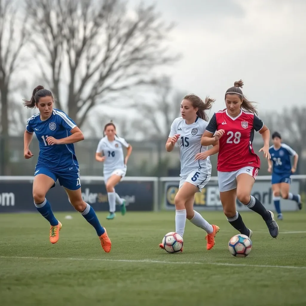
Starkville MS, October 27, 2025 News Summary The Mississippi State soccer team wrapped up their regular season with a disappointing 1-0 home loss against Georgia. The defeat capped a challenging end...

Starkville High School Yellow Jackets Dominate Murrah Mustangs
Starkville, Mississippi, October 26, 2025 News Summary In a decisive victory, the Starkville High School Yellow Jackets overwhelmed the Murrah Mustangs with a score of 55-14 during their homecoming football game....

Texas Longhorns Secure Overtime Win Against Mississippi State
Starkville MS, October 26, 2025 News Summary In a thrilling showdown, the Texas Longhorns pulled off a stunning 45-38 overtime victory against Mississippi State in Starkville. Trailing 38-21 at one point,...

Texas Longhorns Rally to Beat Mississippi State in Overtime
Starkville MS, October 26, 2025 News Summary In a nail-biting game in Starkville, Mississippi, the Texas Longhorns pulled off a stunning comeback against the Mississippi State Bulldogs, winning 45-38 in overtime....

Ethan Pulliam Named Starting Punter for Bulldogs
Starkville, October 24, 2025 News Summary Ethan Pulliam, a Starkville native, has been appointed the new starting punter for the Mississippi State Bulldogs. Initially signed for both baseball and football, Pulliam...

Mississippi State Bulldogs Aim for SEC Victory Against Texas
Starkville MS, October 23, 2025 News Summary The Mississippi State Bulldogs will face the No. 22 Texas Longhorns this Saturday, looking for their first SEC win in 735 days. After a...
BUSINESS

Oktibbeha County Proposes $45 Million Development Project
Oktibbeha County, October 23, 2025 News Summary Oktibbeha County is evaluating a $45 million development project that will convert an old stormwater detention area into a mixed-use complex. Proposed by Desai...

MSU-Meridian Secures $1.2 Million Grant to Enhance Teacher Pipeline
Meridian MS, October 14, 2025 News Summary Mississippi State University-Meridian has been awarded a $1.2 million grant from the Mississippi Department of Education to improve the state’s teacher pipeline. This funding,...

Starkville Launches Free Downtown Wi-Fi Initiative
Starkville, September 27, 2025 News Summary Starkville, Mississippi, has become the first town in the state to introduce a free downtown Wi-Fi initiative, collaborating with MaxxSouth Broadband. The service spans Main...

DeVonte Thomas Promoted to Vice President at Community Bank in Starkville
Starkville, Mississippi, September 26, 2025 News Summary DeVonte Thomas has been promoted to vice president of the Starkville branch of Community Bank. With four years of banking experience and a degree...

Starkville Implements Free Public Wi-Fi in Downtown Area
Starkville MS, September 25, 2025 News Summary Starkville has initiated a new program to offer free public Wi-Fi in its downtown area, facilitating better connectivity for residents and visitors. The service...
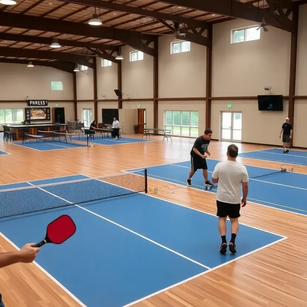
New Indoor Pickleball Facility PKL ROW Set to Open in Starkville
Starkville MS, September 19, 2025 News Summary PKL ROW, a new indoor pickleball facility, is set to launch this spring in Starkville, MS, featuring 12 courts and a bar. Local entrepreneurs...

Baptist Memorial Health Acquires OCH Regional Medical Center
Starkville, September 19, 2025 News Summary Baptist Memorial Health has acquired OCH Regional Medical Center in Starkville, Mississippi, committing $55 million for the purchase and an additional $96.8 million for improvements....

Golden Triangle Development LINK Seeks New Leadership
Golden Triangle, Mississippi, August 27, 2025 News Summary The Golden Triangle Development LINK is searching for a new CEO after the unexpected departure of Joe Max Higgins Jr. This vital economic...

Baptist Memorial Health Care Acquires OCH Regional Medical Center
Starkville MS, August 22, 2025 News Summary Baptist Memorial Health Care has finalized a $55 million agreement to purchase OCH Regional Medical Center, with plans for a $96.8 million investment to...
Events/What's Happening

Texas Longhorns Secure Overtime Victory Against Mississippi State
Starkville, Mississippi, October 27, 2025 News Summary In an action-packed game at Davis Wade Stadium, the Texas Longhorns overcame a 17-point deficit to defeat Mississippi State 45-38 in overtime. With quarterback...

Starkville Set to Host Showdown: Texas vs. Mississippi State
Starkville, Mississippi, October 25, 2025 News Summary This Saturday, Starkville will be the scene of an intense SEC matchup as the No. 18 Texas Longhorns face off against the Mississippi State...

Mississippi State Volleyball Prepares for Big Matches
Starkville MS, October 25, 2025 News Summary This weekend, the Mississippi State volleyball team is set to face two strong rivals, No. 3 Kentucky and No. 16 Tennessee, at Newell-Grissom Arena....

Starkville Prepares for SEC Showdown
Starkville, MS, October 25, 2025 News Summary Starkville, MS, is buzzing as the Mississippi State Bulldogs get ready to face the Texas Longhorns in a crucial SEC clash. With a 4-3...

Texas Longhorns vs Mississippi State Bulldogs Showdown
Starkville MS, October 24, 2025 News Summary The Texas Longhorns will face the Mississippi State Bulldogs in a crucial SEC matchup at Davis Wade Stadium. With both teams eyeing for a...

Texas Longhorns Prepare for Showdown with Mississippi State Bulldogs
Starkville MS, October 23, 2025 News Summary The Texas Longhorns are gearing up for a critical clash against the Mississippi State Bulldogs in Starkville, MS. Scheduled for October 25th, betting lines...

Texas Longhorns to Face Mississippi State Bulldogs
News Summary The Texas Longhorns are set to battle the Mississippi State Bulldogs in an SEC showdown at Davis Wade Stadium. Both teams, with their unique strengths and challenges, are...

Ella Langley Releases New Single ‘Choosin’ Texas’ in Houston
Houston, October 22, 2025 News Summary Ella Langley has released her new single ‘Choosin’ Texas,’ delighting fans in Houston with its heartfelt themes of heartbreak and strength. Co-written with Miranda Lambert...

Coach Jeff Lebby Supports Kicker Kyle Ferrie After Loss
Starkville MS, October 22, 2025 News Summary After a heartbreaking 23-21 defeat against the Florida Gators, Coach Jeff Lebby stands firmly behind kicker Kyle Ferrie, who faced criticism for missing a...
CRIME

Couple Arrested for Exploiting Vulnerable Adult in Starkville
Starkville, October 17, 2025 News Summary A couple from Starkville, Thomas and Kimberly Watts, faces serious charges including felony exploitation of a vulnerable adult and possession of a controlled substance. The...

30 Arrested in Drug Trafficking Operation in Oktibbeha County
Oktibbeha County, September 13, 2025 News Summary A major law enforcement initiative, Operation Cottonmouth, has resulted in the arrests of 30 individuals involved in drug trafficking across Oktibbeha County. The operation...

Shooting Incident in Starkville Leaves Victim Critical
Starkville, August 29, 2025 News Summary A shocking shooting incident in Starkville has led to a 21-year-old man, Marshall Overstreet, being charged with attempted murder. The shooting took place at the...

Starkville Police Arrest Suspect in Attempted Murder Case
Starkville, August 28, 2025 News Summary Starkville police have arrested 21-year-old Marshall Overstreet for attempted murder after a shooting incident left one individual in critical condition. The incident occurred at The...

Shooting Incident Near The Social Block in Starkville
Starkville, August 26, 2025 News Summary A shooting near The Social Block apartments in Starkville injured a bystander on Friday night. Local police responded swiftly to reports of gunfire at approximately...

Spike in Apartment Scams Targeting Starkville College Students
News Summary As the new semester approaches, Starkville college students, particularly those at Mississippi State University, face a rising threat from rental scams. The Starkville Police Department has received multiple...
POLITICS

Starkville, Mississippi Ranks 64th Among College Towns
Starkville, Mississippi, October 22, 2025 News Summary WalletHub has ranked Starkville, Mississippi, 64th out of 415 college towns in the U.S., highlighting both its affordability and challenges in social and academic...

New Specialty School Proposed Alongside Starkville High School
Starkville MS, September 27, 2025 News Summary The Mississippi School for Mathematics and Science will not be part of the new Starkville High School plans. Discussions are ongoing about building a...

Starkville Welcomes Linebacker Jalen Smith and Art Briles
News Summary Mississippi State University has welcomed linebacker Jalen Smith, who has personal ties to Mississippi, to their football team. Smith, a former Tennessee player, aims to bolster the Bulldogs’...

Mississippi State University Faces Funding Challenges and Coaching Changes
News Summary Mississippi State University is experiencing significant challenges due to potential loss of federal research funding following recent policy changes. This financial strain is impacting essential services, particularly health...
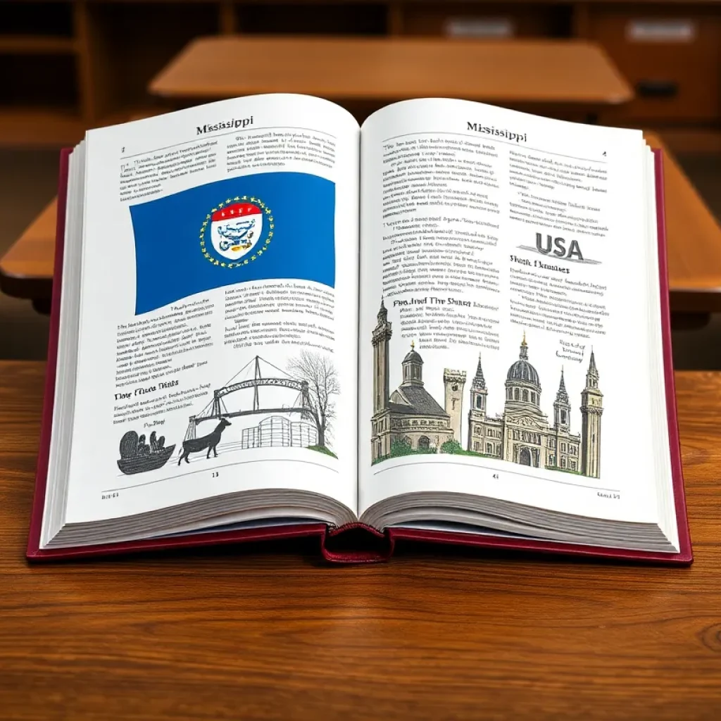
Revision of Mississippi History Textbook for Students
News Summary A significant revision of the state history textbook, “Mississippi: Our History, Our Home,” is set to launch this fall. Co-authored by Kenneth Anthony from Mississippi State University, the...

Top Outfielder Michael Hanna Recommits to Mississippi State
News Summary Michael Hanna, a standout left-handed outfielder, has recommitted to Mississippi State University’s baseball program after a coaching change at Virginia. Originally committed to Virginia, Hanna was influenced by...

Mississippi Board Recommends MSMS Relocation to MSU
News Summary The Mississippi State Board of Education has recommended relocating the Mississippi School for Mathematics and Science (MSMS) from MUW to MSU starting in 2026-27, despite public opposition. Most...

Sam Purcell Signs Contract Extension with Mississippi State Women’s Basketball
News Summary Sam Purcell, head coach of the Mississippi State women’s basketball team, has signed a contract extension through the 2028-29 season. Entering his fourth year, Purcell has led the...

Blake Shapen Receives Philanthropic Spirit Award
News Summary Blake Shapen, starting quarterback for Mississippi State University, has been honored with the Philanthropic Spirit Award by the NIL Store. This award celebrates athletes for their philanthropic contributions...
SPORTS
Texas Longhorns Secure Overtime Victory Against Mississippi State
Starkville, Mississippi, October 27, 2025 News Summary In an action-packed game at Davis Wade Stadium, the Texas Longhorns overcame a 17-point deficit to defeat Mississippi State 45-38 in overtime. With quarterback...
Starkville Set to Host Showdown: Texas vs. Mississippi State
Starkville, Mississippi, October 25, 2025 News Summary This Saturday, Starkville will be the scene of an intense SEC matchup as the No. 18 Texas Longhorns face off against the Mississippi State...
Mississippi State Volleyball Prepares for Big Matches
Starkville MS, October 25, 2025 News Summary This weekend, the Mississippi State volleyball team is set to face two strong rivals, No. 3 Kentucky and No. 16 Tennessee, at Newell-Grissom Arena....
Starkville Prepares for SEC Showdown
Starkville, MS, October 25, 2025 News Summary Starkville, MS, is buzzing as the Mississippi State Bulldogs get ready to face the Texas Longhorns in a crucial SEC clash. With a 4-3...
Texas Longhorns vs Mississippi State Bulldogs Showdown
Starkville MS, October 24, 2025 News Summary The Texas Longhorns will face the Mississippi State Bulldogs in a crucial SEC matchup at Davis Wade Stadium. With both teams eyeing for a...
Texas Longhorns Prepare for Showdown with Mississippi State Bulldogs
Starkville MS, October 23, 2025 News Summary The Texas Longhorns are gearing up for a critical clash against the Mississippi State Bulldogs in Starkville, MS. Scheduled for October 25th, betting lines...
Texas Longhorns to Face Mississippi State Bulldogs
News Summary The Texas Longhorns are set to battle the Mississippi State Bulldogs in an SEC showdown at Davis Wade Stadium. Both teams, with their unique strengths and challenges, are...
Coach Jeff Lebby Supports Kicker Kyle Ferrie After Loss
Starkville MS, October 22, 2025 News Summary After a heartbreaking 23-21 defeat against the Florida Gators, Coach Jeff Lebby stands firmly behind kicker Kyle Ferrie, who faced criticism for missing a...

Georgia and Alabama Dominate in SEC Week 8
Starkville MS, October 21, 2025 News Summary SEC Week 8 delivered exhilarating football action with Georgia and Alabama showcasing their prowess. Georgia edged Ole Miss 43-35, while Alabama defeated Tennessee 37-20....